DunLuce Castle Ruins

DunLuce-from-ridge

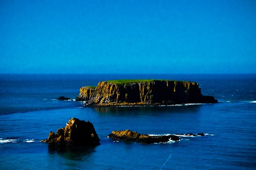
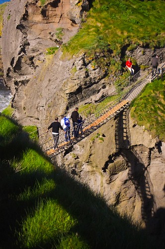
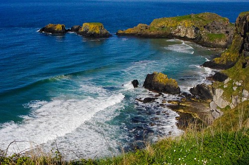
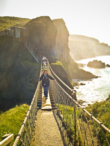
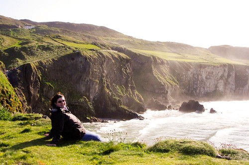
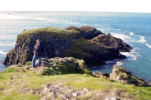
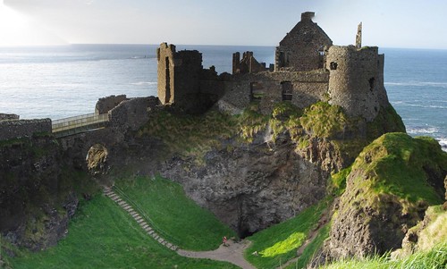
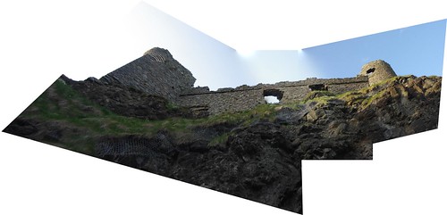
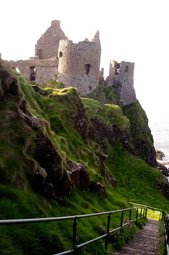
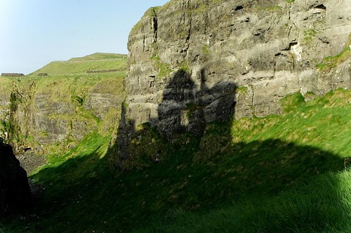
Just before sunset, back in April, as part of our day trip around Northern Ireland, Jacqui, Liz and I popped along the coast road in the hopes of making it up to DunLuce castle ruins. This is supposed to be one of the most beautiful cliff face castles that spans its own small island and then connects to the mainland by a bridge and dual gatehouses. I have to say that it was great for photographs, and because of the “Sweet light” hours that we made it, we got some neat shadow pictures too.

DunLuce-hilltop

The first castle was built on the site sometime in the 1200’s, high up on the cliffs on the coast. Prior to this, there may have been an ancient fort here as well. The remnants of which can be seen in the two round towers, 30 foot in diameter.

IMGP1431-38

The first documented castle on the site was built in 1513, by the McQuillin family, using the remains of prior structures. It was updated in 1584, after a change of hands to Scottish lords, to the latest Scottish styles, adding the gatehouses and separate kitchens.

IMGP1429-36

According to a history, sometime after 1584, part of the cliff face collapsed into the sea and took down the kitchen buildings with it. Supposedly, only one lucky kitchen boy survived – because he was sitting in the corner of the kitchen which remained. At that time, the wife of the owner declared she would no longer live there.

IMGP1426-33

Sometime after 1690, the family owners lost their funds and the castle fell into disrepair.

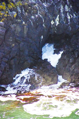
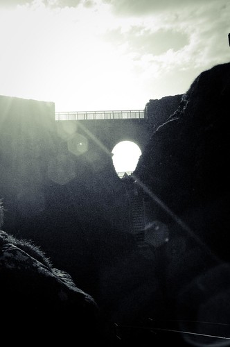
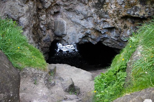
Today, the castle is a privately owned tourist site, where you can walk around parts of the old castle grounds and down a steep set of stairs to look up at the castle above. Under the castle is a water carved cave (smugglers cove anyone)

IMGP1405-16

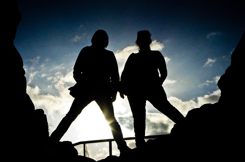
and a neat archway which allows for some great sunset silhouettes (and shadows.)

IMGP1412-20

For a virtual tour, please see:

www.doeni.gov.uk/niea/places/monuments/dunluce.shtml

To see more of my flickr set of DunLuce, please click here.

Share

Carrick-A-Rede Rope Bridge

Back in April of this year, I took a beautiful day trip excursion to the Giant’s Causeway with my friend Jacqui and her long time friend, Liz. The northern coast of Eire is a different country (Northern Ireland is a part of the UK) and it took us about 3 hours to drive from here in Dublin up through Belfast before we hit the coast road.

Blue blue blue

While up in Northern Ireland, one of the places that we stopped was the National Trust site at Carrick-a-Rede. Now this place doesn’t sound too scary – Carrick is Irish for “Rock in the road”. That is, until I tell you that the place has had a rope suspension bridge of some form connecting the Irish “mainland” to the island of Carrick for some 250 years. Originally built for Salmon fisherman who caught salmon that went around the edge of the Carrick (not anymore as the salmon are gone) as they headed inland to spawn, the rope bridge has now been taken over by the National Trust and is now part of a national park.

IMGP1350-17

The rope bridge is there and now a tourist attraction. It spans 20 meters across from the mainland to the isle of Carrick, across two sheer cliff faces – to rocks and shallow sea some 30 meters (230 feet) below. Now for someone (me) with a fear of falling (me) it’s a beautiful view as you hike up along the cliff tops… and stand in line to cross the rope bridge, up to 6 at a time.

IMGP1341-8

The crossing itself, however, is completely different.
That's not a smile, that's a grimace...

You climb down a series of metal stairs and then line up to go across the bridge with thin planking and ropes holding together for your hands. The rope bridge bounces as people go across, and swings slightly in the wind. Yes, I crossed, but let me tell you, this is NOT a smile. This is a grimace, and I’m repeating to myself “don’t look down” “don’t look down” “don’t look down” so that I don’t freeze mid-bridge.

Once across, the island of Carrick isn’t very big. It’s maybe 200 meters long, but it affords some gorgeous views of the salt spray, the cliffs, and some birds and fauna that are specific to the island itself. It even inspired me to throw caution to the wind, enjoy some sun, watch the waves breaking through the island caves…

Island Cave tunnel 3

and hang my feet over the cliff edge….

Danger!!

Ok so not really. There’s a ledge under my feet, but I had you there for a minute, right?!?

And so, from me .. until the next blog…I stand at the edge of Europe, thinking of you folks “across the pond”.

The edge of Europe... and a cliff.

For more pictures from Carrick-a-rede, please see my flickr set here.

Share

Lutherstadt-Wittenberg

I’m back processing a few old pictures (and some more recent ones) in between trying to do school work and work overtime at my job. Now that the weather in Ireland has reverted to the chill of fall, let’s see if I can get some new stuff posted and viewable from my busy life. 🙂

IMGP1918-28

This is more from my day trip to Lutherstadt-Wittenberg, Germany back in 2009 with the Toytown Photo group. It took place on September 19, 2009 – two years ago today.

IMGP1931-40

The Town Hall

Population about 50,000, this town sits along the beautiful Elbe river. This is the famed town of Martin Luther, where he wrote and posted his edicts on the church doors as part of the Protestant revolution. When in Germany, this town is one of the “must see’s” because of its place in history and the role it played as a part of “enlightenment”.

Wittenberg town square merge

The church towers are for the city church, where Martin Luther preached his then controversial message.

The main pilgrimage point in town is actually the Schloss kirche, upon which Martin Luther nailed his 95 Thesis on the door of the church back on October 31, 1517. The original door no longer exists, but today, the door is metal with a cast plate of the thesis itself.

IMGP2001-106

IMGP2008-113

For more pictures, you can check out the three flickr sets below:

Lutherstadt-Wittenberg

St. Marien Lutherstadt (City Church)

Schloss Kirche Wittenberg

Share