Giant’s Causeway

IMGP1251-7

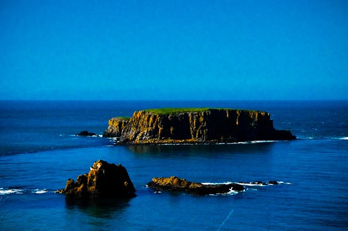
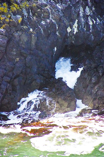
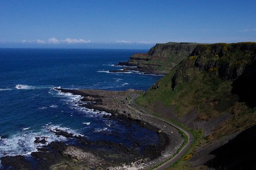
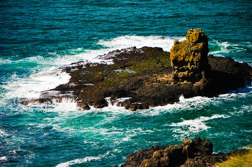
Far on the north coast of Ireland is an area of about 40,000 interlocking naturally occuring basalt columns. They were caused by a volcanic eruption, and is a Unesco world heritage site. Last April, I took a beautiful day trip excursion to the Giant’s Causeway with my friend Jacqui and her long time friend, Liz to see this fascinating place.

IMGP1313-53

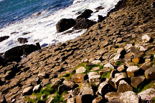
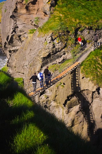
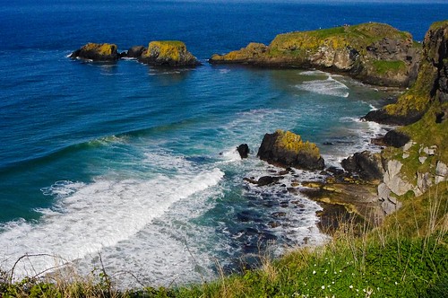
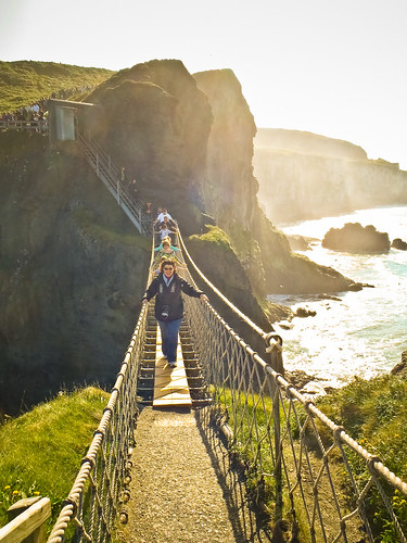
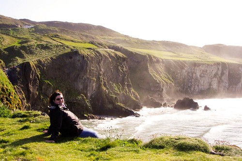
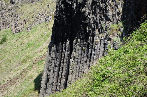
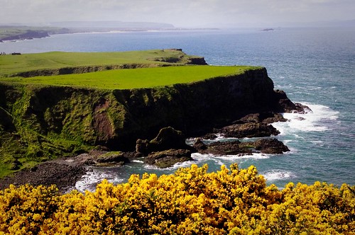
The causeway itself is actually an area of several horse-shoe shaped inlets which can be reached by a cliff top walk, a hike down a series of 162 steep stairs (known as the shephards steps), or a cheeky little bus taken from the Giant’s causeway hotel. On the way down, we chose to take the cliff walk/stairs – and then the bus back – because the weather was so beautiful. We went past the Pipe Organ (below), and into a giant bowl shaped area known as the Ampitheater.

IMGP1262-18

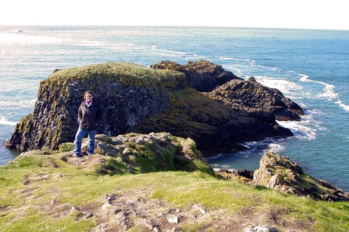
On the way back we passed the Giant’s Boot, pipe, and also his Camel. According to Irish legend, the Irish warrior Fionn mac Cumhaill (Finn McCool) built the causeway to walk to Scotland to fight his Scottish counterpart Benandonner. At some point, tired of waiting, the Scottish Giant came across the water, and somehow, Fionn found out. Realizing that the scottish giant was larger than he himself, Fionn asked his wife to dress him up as a baby. When Benandonner saw the baby, he thought that Fionn must be a truly large giant indeed (because of the size of the baby) and fled back to Scotland, leaving his boot and pipe behind him on the beach.

IMGP1306-48
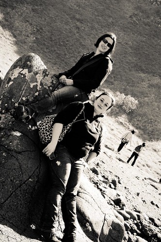
Jacqui and Liz posing on the boot…

IMGP1277-31
Looking out towards the pipe stem
IMGP1247-3
The Camel, sleeping after the long walk (Giants need something larger than a horse, apparently)

You can see more photos on the Giant’s Causeway flickr set here.

Share

Carrick-A-Rede Rope Bridge

Back in April of this year, I took a beautiful day trip excursion to the Giant’s Causeway with my friend Jacqui and her long time friend, Liz. The northern coast of Eire is a different country (Northern Ireland is a part of the UK) and it took us about 3 hours to drive from here in Dublin up through Belfast before we hit the coast road.

Blue blue blue

While up in Northern Ireland, one of the places that we stopped was the National Trust site at Carrick-a-Rede. Now this place doesn’t sound too scary – Carrick is Irish for “Rock in the road”. That is, until I tell you that the place has had a rope suspension bridge of some form connecting the Irish “mainland” to the island of Carrick for some 250 years. Originally built for Salmon fisherman who caught salmon that went around the edge of the Carrick (not anymore as the salmon are gone) as they headed inland to spawn, the rope bridge has now been taken over by the National Trust and is now part of a national park.

IMGP1350-17

The rope bridge is there and now a tourist attraction. It spans 20 meters across from the mainland to the isle of Carrick, across two sheer cliff faces – to rocks and shallow sea some 30 meters (230 feet) below. Now for someone (me) with a fear of falling (me) it’s a beautiful view as you hike up along the cliff tops… and stand in line to cross the rope bridge, up to 6 at a time.

IMGP1341-8

The crossing itself, however, is completely different.
That's not a smile, that's a grimace...

You climb down a series of metal stairs and then line up to go across the bridge with thin planking and ropes holding together for your hands. The rope bridge bounces as people go across, and swings slightly in the wind. Yes, I crossed, but let me tell you, this is NOT a smile. This is a grimace, and I’m repeating to myself “don’t look down” “don’t look down” “don’t look down” so that I don’t freeze mid-bridge.

Once across, the island of Carrick isn’t very big. It’s maybe 200 meters long, but it affords some gorgeous views of the salt spray, the cliffs, and some birds and fauna that are specific to the island itself. It even inspired me to throw caution to the wind, enjoy some sun, watch the waves breaking through the island caves…

Island Cave tunnel 3

and hang my feet over the cliff edge….

Danger!!

Ok so not really. There’s a ledge under my feet, but I had you there for a minute, right?!?

And so, from me .. until the next blog…I stand at the edge of Europe, thinking of you folks “across the pond”.

The edge of Europe... and a cliff.

For more pictures from Carrick-a-rede, please see my flickr set here.

Share

Lutherstadt-Wittenberg

I’m back processing a few old pictures (and some more recent ones) in between trying to do school work and work overtime at my job. Now that the weather in Ireland has reverted to the chill of fall, let’s see if I can get some new stuff posted and viewable from my busy life. 🙂

IMGP1918-28

This is more from my day trip to Lutherstadt-Wittenberg, Germany back in 2009 with the Toytown Photo group. It took place on September 19, 2009 – two years ago today.

IMGP1931-40

The Town Hall

Population about 50,000, this town sits along the beautiful Elbe river. This is the famed town of Martin Luther, where he wrote and posted his edicts on the church doors as part of the Protestant revolution. When in Germany, this town is one of the “must see’s” because of its place in history and the role it played as a part of “enlightenment”.

Wittenberg town square merge

The church towers are for the city church, where Martin Luther preached his then controversial message.

The main pilgrimage point in town is actually the Schloss kirche, upon which Martin Luther nailed his 95 Thesis on the door of the church back on October 31, 1517. The original door no longer exists, but today, the door is metal with a cast plate of the thesis itself.

IMGP2001-106

IMGP2008-113

For more pictures, you can check out the three flickr sets below:

Lutherstadt-Wittenberg

St. Marien Lutherstadt (City Church)

Schloss Kirche Wittenberg

Share