Old Mellifont Abbey

February day trip around Drogheda, Part II.

Old Mellifont Abbey dating to the 11th Century AD.

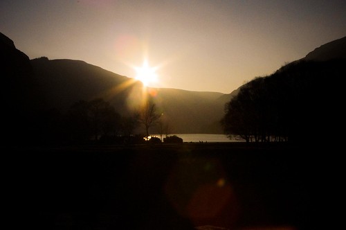
Yesterday, I told you about a brief visit to the town of Drogheda. After I had a coffee to warm up, I decided that it was worth driving the 10 km through the countryside to the Old Mellifont Abbey Ruins. The weather was starting to look more promising, and the fog was starting to burn off the hilltops.

Old Mellifont Abbey dating to the 11th Century AD.

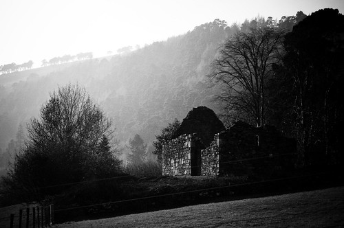
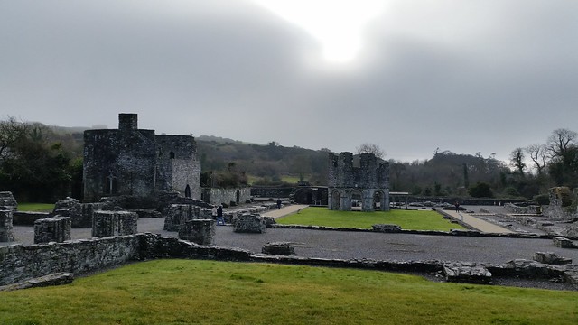
I was hopeful that the fog would be at the Abbey Ruins still, to make for some interesting photographs. Lucky for me, when I arrived, the visitor center (formerly Ireland’s first youth hostel) was closed, there was only one small family about, and we had the place pretty much to ourselves because of the cold and poor weather. As the day warmed up though – you can see in the pictures that the fog turned to sun and changed the mood entirely.

Old Mellifont Abbey dating to the 11th Century AD.

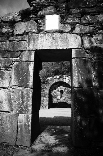
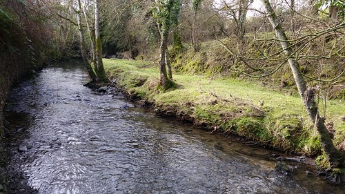
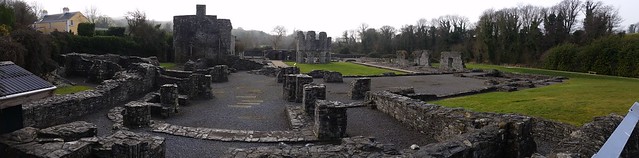
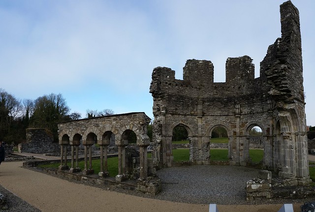
Old Mellifont Abbey was founded in 1142 by St. Malachy and was one of the first Cistercian Monasteries in Ireland. It sits on the river Mattock, which runs cheerfully bubbling through the countryside of green rolling hills. By 1170, the abbey had become an example for other abbeys built in Ireland and France architecturally. It was populated by 100 monks and 300 lay persons at the height of its influence. In 1539, it was closed (Henry the VIII) and taken over becoming a fortified house (the entry gate dating to the 15th century below).

Old Mellifont Abbey dating to the 11th Century AD.

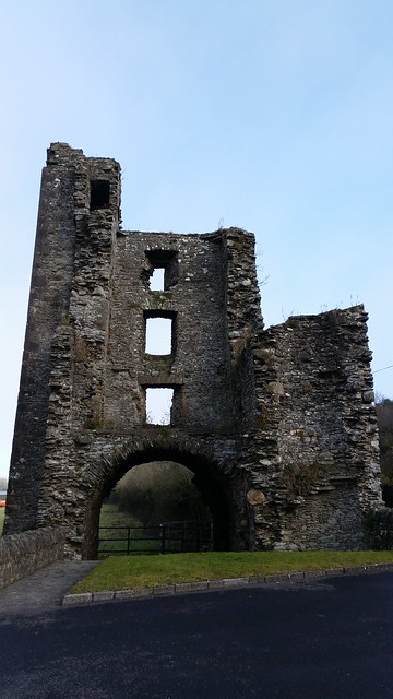
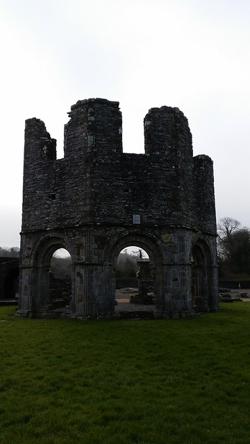
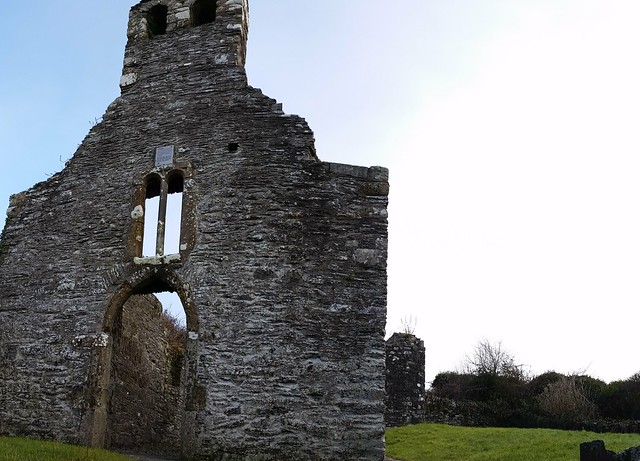
In 1690, William of Orange used the fortified house at Mellifont Abbey as his headquarters during the Battle of the Boyne. Sadly, not long after the house went into ruins. There are only a few portions that are visible. You can walk about and see the knee high wall remnants for most of the site. The few higher walls that remain are an octagonal shaped section that dates back to the 13th century called the Lavabo. This is where the monks washed their hands before eating.

Old Mellifont Abbey dating to the 11th Century AD.

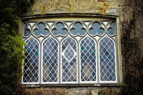
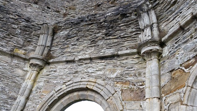
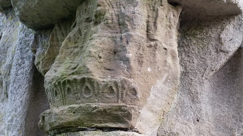
Reverse side Lavobo and some of the details like the arches, stonework, and windows:

Old Mellifont Abbey dating to the 11th Century AD.

Old Mellifont Abbey dating to the 11th Century AD.

Old Mellifont Abbey dating to the 11th Century AD.

Old Mellifont Abbey dating to the 11th Century AD.

Old Mellifont Abbey dating to the 11th Century AD.

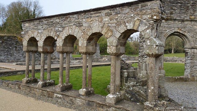
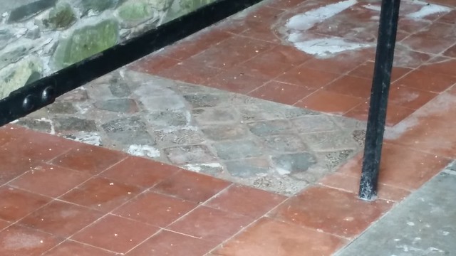
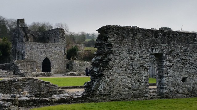
The other sections of interest are the 14th century Chapter house (with Romanesque arches and tiled floor) from about 1220:

Old Mellifont Abbey dating to the 11th Century AD.

Old Mellifont Abbey dating to the 11th Century AD.

Old Mellifont Abbey dating to the 11th Century AD.

and the arched wine cellar (upper right hand corner of the picture below):

Old Mellifont Abbey dating to the 11th Century AD.

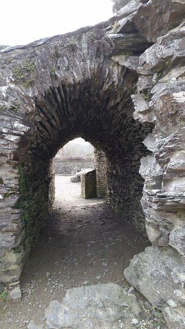
As well as the stone walkway to keep one dry going between buildings:

Old Mellifont Abbey dating to the 11th Century AD.

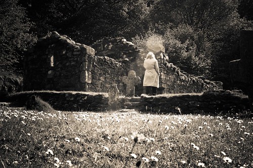
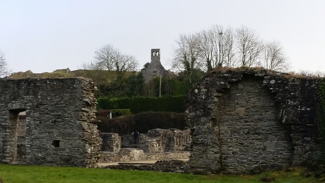
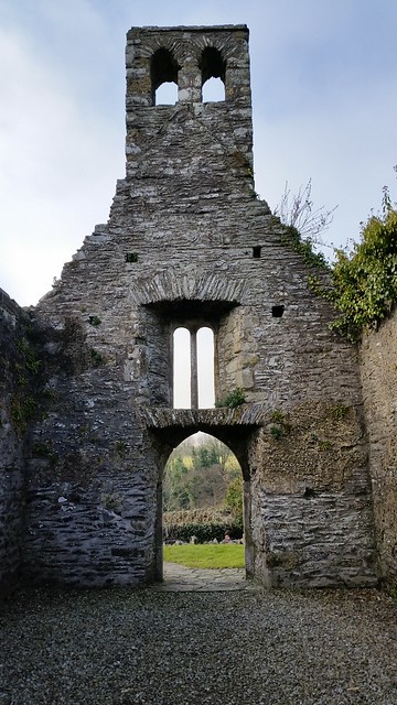
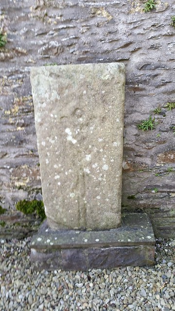
Up the hill there’s the walled ruins of a small chapel (center of the picture directly below) which you can find an old celtic cross gravestone.

Old Mellifont Abbey dating to the 11th Century AD.

Old Mellifont Abbey dating to the 11th Century AD.

Old Mellifont Abbey dating to the 11th Century AD.

Old Mellifont Abbey dating to the 11th Century AD.

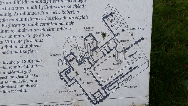
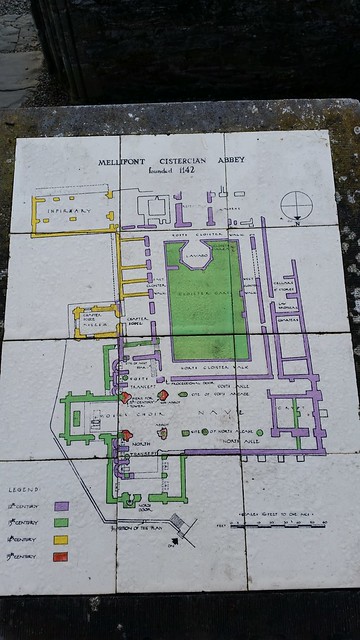
You can see a map of the general layout of the abbey pre -becoming ruins here:

Old Mellifont Abbey dating to the 11th Century AD.

Old Mellifont Abbey dating to the 11th Century AD.

Old Mellifont Abbey dating to the 11th Century AD.

Overall the site is worth a visit just to see the layout, and because it is “free” to visit (not sure about the visitor center). I found out later that the visitor center has a good display of the architectural ruins and artifacts that have been uncovered in the area. I may need to go back to check this out. Otherwise, from here I headed back in time – to the Monasterboice Abbey Ruins – which dated to the viking times (1000 years younger) and was closed with the start of the Mellifont Abbey. More on that tomorrow.

For now, feel free to see more pictures from Mellifont Abbey in my flickr photostream.

Share

Glendalough Ruins and Lakes

Back in March, and again the beginning of June, I decided that I needed to get out of the city and go see a bit more of Ireland. I had heard many lovely things about a place called “Glenda-lock”, which is situated in the Wicklow mountains. I have to say that after taking a friend there in March, I had to return in June (when the weather was better) and take my mom and a bunch of photographs.

IMGP1220-67
(Sunset at the Upper Lake at Glendalough)

Glendalough (Irish: Gleann Dá Loch, meaning “Glen of Two Lakes”) is one of the most visited places in Ireland. It’s located in the Wicklow Mountains National Park and has lots of walks and trails. The Glendalough Valley was carved out by glaciers during the Ice Age and the two lakes, from which Glendalough gets its name, were formed when the ice eventually thawed.

IMGP1175-39
(House ruins with foggy mountain in the background)

It is also renowned for its Early Medieval monastic settlement founded in the 6th century by St Kevin, a hermit priest (now in ruins). Kevin was born to one of the ruling families of Leinster, and studed under several early Christian leaders. During this time, he went to Glendalough and was enchanted by its beauty.

IMGP1592-7
(St. Kevin’s Cell)

IMGP1597-1
(Looking through the interior of St. Kevin’s Cell)

Shortly later, St. Kevin returned with several monks to found a monestary. As his fame spread, the settlement grew. Kevin died in 618, but the settlement continued for nearly 600 years – surviving through Viking Raids and deaths of many Abbots. In 1398, English troops finally invaded and destroyed the peaceful monestary for good.

IMGP1139-10>
(Cemetery with 30 meter high Round tower to watch for raiders – Lower lake of Glendalough)

Since then, the place has remained one of pilgrimage, and I can see why as it’s one of the most beautiful places I’ve ever seen. It’s mentioned in many manuscripts and there are remnants of cemeteries, workshops, guest houses, infirmaries, farm buildings and dwellings all over the upper and lower lakes. Most of the buildings that exist today are from the 10th and 12th centuries.

IMGP1169-33
(St. Kevin’s church)

For More information, please see http://www.glendalough.ie/heritage_of_glendalough.php

For more pictures of my trips there, please see my flickr set.

Share

A Day trip to Malahide Castle

IMGP2325-4

Malahide Castle is one of the oldest and most historic castles on the East Coast of Ireland, just North of Dublin. From 1185 until 1975, (Nearly 800 years) it was the home of the Talbot family – with only one short exception – the period from 1649-1660, when Oliver Cromwell granted it to Miles Corbet after the Cromwellian conquest of Ireland. (Miles Corbet was later hanged and the home restored to the Talbot family.)

IMGP2322-1

In 1169, at the time of the Anglo-Norman invasion, Malahide township was under the control of Hammund Mac Turkill, the last Viking King of Dublin. As the Normans gained land under Henry II starting in 1174, they were granted out to English noblemen. The actual estate began in 1185, when Richard Talbot, a knight who accompanied England’s King, Henry II to Ireland in 1174, was granted the “lands and harbour of Malahide” (something like 600 acres). Strongbow (I seriously love this guy’s name) was granted the remainder of Leinster county.

IMGP2328-7

The oldest parts of the castle date back to the 12th century, including the current cafe area and a circular staircase which led to the original 13th century keep. Starting during Edward the IV, the building was added on to. In the 1640’s, under Cromwell, the building itself, old moats, and walls started falling into disrepair as they were filled in and/or harvested for stone building projects. In 1700, the Talbots worked to restore the building to live-able condition, tearing down the fortifications – and vowing that never again should the castle be held by “userpers”. In the place of the fortifications, they planted evergreens on the grounds and started the botanical gardens. The round towers also added in 1765, and several of the windows (including the ones in the great hall) were enlarged. In the years between 1765 and 1782, there was a fire which damaged the west wing of the castle. During the restoration, drawing rooms were added and alternations to the bedrooms (raising ceilings / floors) were made.

One feature on the inside (no pictures allowed inside during the internal tour) is a beautiful Oak Room with carved 16th century wood paneled walls and fireplace. The carvings are all out of the bible, and it is known as one of the best examples of this type of carving in Ireland. The Oak Room itself was expanded in 1820 when the entrance porch was added.

IMGP2323-2

Today, the castle and gardens encompass some 260 acres of parkland (which consist of wooded areas, cricket greens, soccer fields, a golf course, numerous hiking trails, tennis courts, etc.) and the Talbot Botanic Gardens. The Demense as the parkland is known, is one of the few surviving examples of 18th century landscaped parks, and the Botanic Gardens are known for their many plants from the southern hemisphere and the Victorian conservatory. The castle and grounds can easily be seen in a day trip from Dublin (as is evidenced by me taking my mom while she was visiting) and offers a good day out in good or bad weather. (I recommend trying the food at the cafe inside the castle – delicious!)

IMGP2334-12

For more information, please see the Malahide Castle Website at:

http://www.malahidecastle.com/history.asp

Share