Sunday Drive around Drogheda Part III (Final)
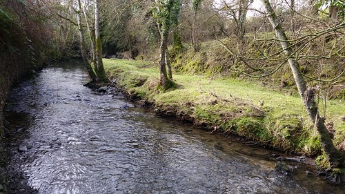
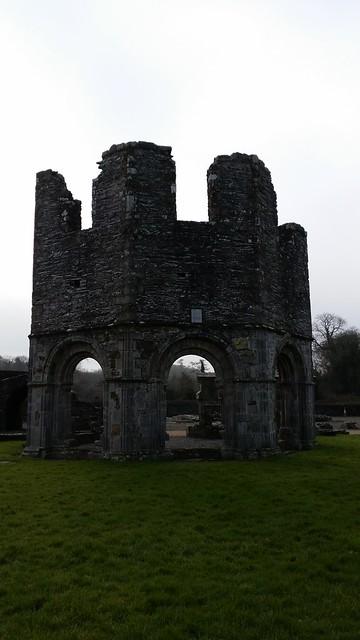
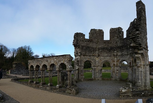
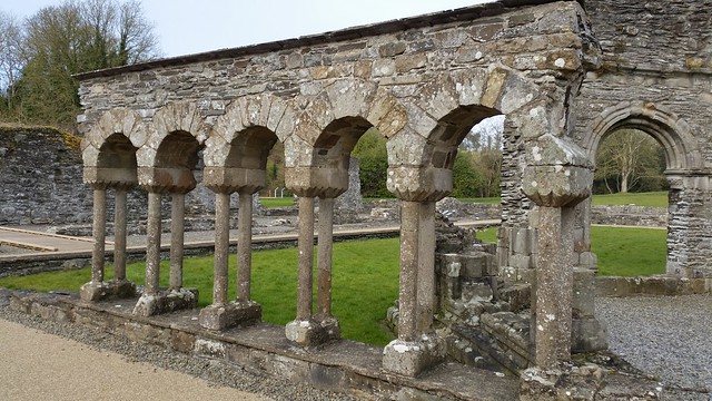
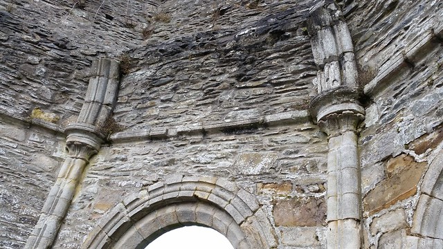
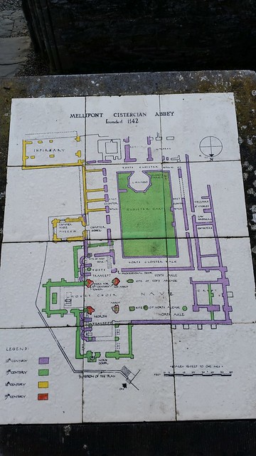
From Old Mellifont Abbey, now that the weather was clearing up a bit, I continued my Sunday drive another 8km (about 4 miles) down the main road further into the countryside to check out Monasterboice Abbey. With each passing kilometer, I was effectively moving back in time (Drogheda founded in 1194, Mellifont Abbey founded 1142) and in history.
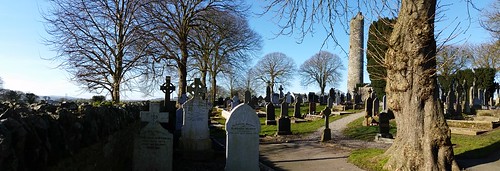
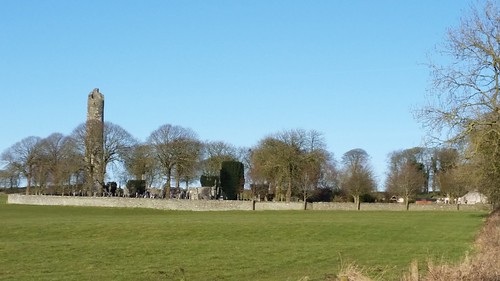
The area in and around Monasterboice has had a long history. It’s a free site which you can visit, and it sits in the middle of several fields and down a long single track lane road. As you approach, you can see that it was a pretty impressive settlement – especially with the round tower visible from far away. Closer up, the gates reveal that there are the old style “steps” which kept the abbey secure and held in the livestock – but allowed for entry/exit of people.

The region has some pre-christian artifacts that have been discovered, though it’s unclear how they relate to this particular site and religious practices. The “current” site at Monasterboice was founded by Saint Buithe sometime at the end of the 4th century / beginning of the 5th century AD (Saint Bruithe died in 521 AD). It is from the Saint that the nearby River Boyne gets its name.
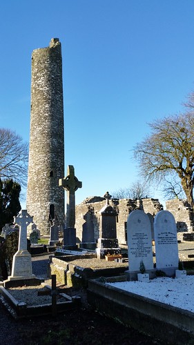
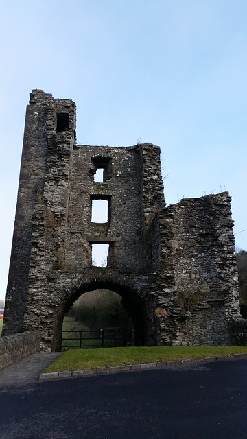
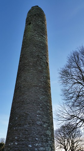
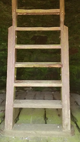
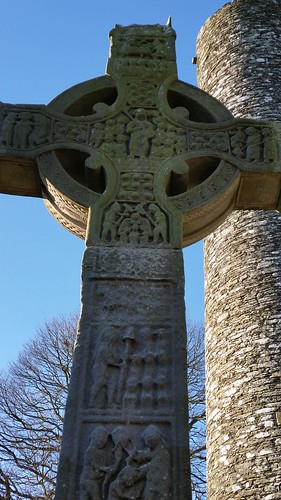
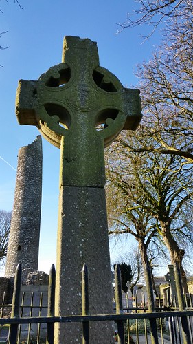
Other than a list of the Abbots who served the Abbey between 759 and 1122, there is little known about the history of the monastery. Some documentation shows that the Monasterboice was raided by the Vikings. The 30 Meter high (110 foot) Round tower was built in the 9th century to help see the raiders before they came. The 4 story tower served both as the watchtower/ belfry (to warn of attack) and also the treasury where books, relics, and other religious items were kept. It was also a place of refuge for the monks in times of need (The door is part of the way up the wall, accessed by a ladder which was pulled into the door during raids). (looking up at the tower from ground level below, and the ladder inside).
In 950s AD, (Some 400 years after Monasterboice’s founding) the Vikings finally did capture the site and held on to it until 968 AD when there was a great slaughter of the Vikings in the region by Brian Boru (Leader of the Irish) in an attempt to drive them out of the region. They were only temporarily successful, however, as the Vikings did continue to raid the region. The Round tower and parts of the complex were burned in 1097 along with all the books contained in the monastery.
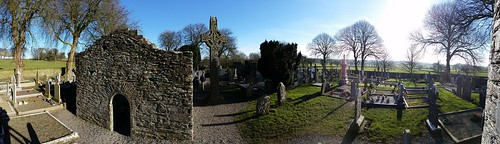
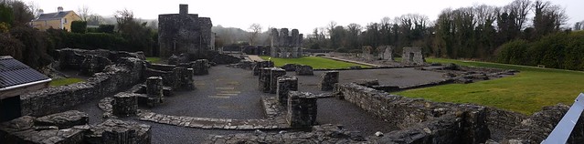
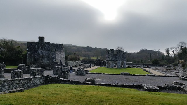
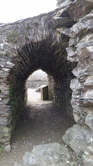
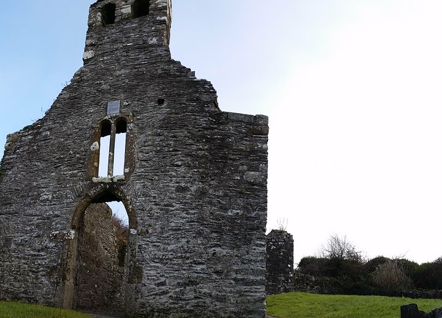
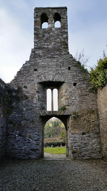
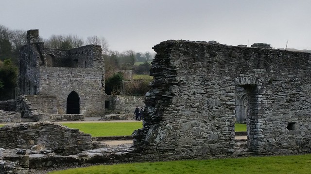
Finally, in the 1100’s the Normans came to Ireland, and it was the beginning of the end for the settlement at Monasterboice. Once Old Mellifont Abbey was built in 1142, the main facilities here slowly went into decline. By the 13th century, only a small parochial church presence was maintained in 2 small church buildings (built in the 14th century) the ruins of which can still be seen today.
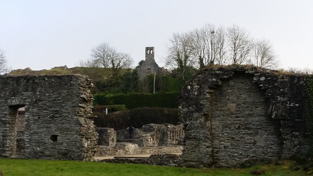
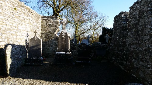
The South Church – formerly made up of Nave and Chancel, with archway in the back wall:


The North Church – where the east windows and most of the “gable” are gone:

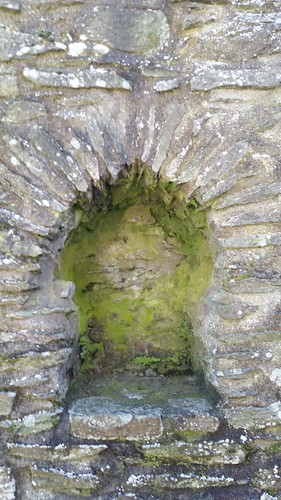
Icon niche:
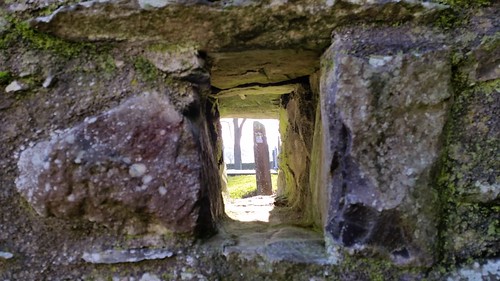
Window:
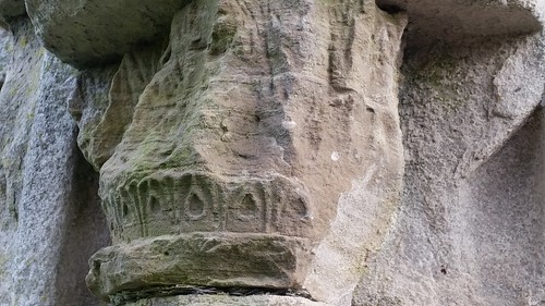
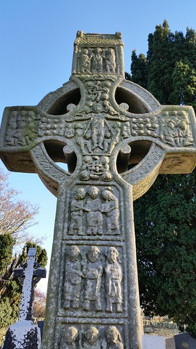
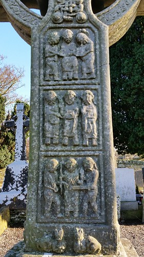
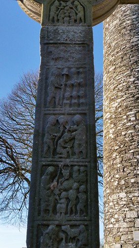
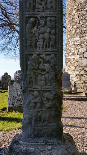
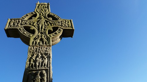
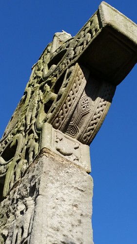
In addition to the impressive Round tower from the 10th Century, and the ruins of the 2 churches, there are also 3 high crosses made of carved sandstone on the site, two of which are supposed to be the finest in all Ireland. These High Crosses were used to tell Biblical tales to those that couldn’t read (similar to how the Gothic churches used the stained glass windows a few centuries later). The most famous of the High Crosses is Muiredach’s High Cross, and it is 5.5 meters (16 feet) high and sits just to the right as you enter. The cross is named after the abbott at the time it was built (Muiredach mac Domhnaill) who died in 923 AD, and whose name is inscribed on the base.
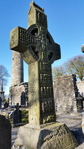
According to Sacred Destinations website the carvings on the Muiredach’s cross represent a theme of Sin/Sinners and Christ’s saving of the people. (See the linked site for a much more detailed explanation of all 3 crosses).

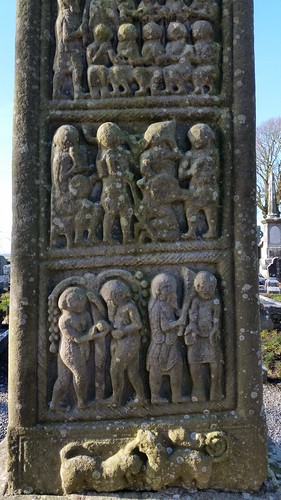
The second cross is called the “west cross” or the high cross – and is next to one of the church ruins / directly across from the round tower. This cross is about 7 meters (23 feet) high. It’s slimmer than the others but actually has more carving due to its respective height. This too dates to around the 900 ADs and has a theme of miracles and Heroism performed.
Magalithic Ireland website has another decent description of the depictions on this cross but include Moses smiting water from a rock, David with Goliath’s head, and Samuel Anointing David, and the Resurrection to name a few.
Side 1:
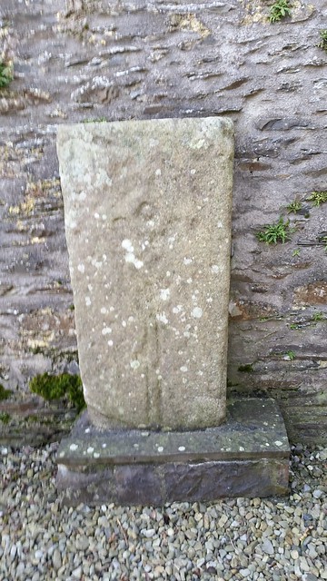
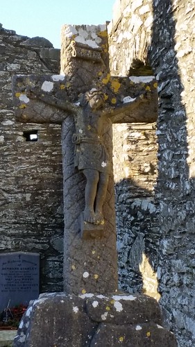
The third and final cross on the site is known as the North Cross, and is very simply carved. It was smashed by Oliver Cromwwell’s forces but has been repaired since, and the base has also been replaced. It’s contained behind a metal fence with the original shaft propped nearby and along side it is a sundial and a few “ruine” stones.
Personally, I found the place quite peaceful on a Sunday morning. There were a few dog walkers out enjoying the countryside as I pulled in, and an older couple tending the family graves. As we were about to leave, they struck up a brief conversation asking where I and a couple others exploring the site were from. Amusingly, the other two ‘visitors’ were also from the US and proceeded to comment on the heritage and history of Ireland. 🙂 I recommended a few other local sites, and they headed on their way.

If you’d like to see a few more pictures of the location, you can see the full set here.